Boating the Llano River Near Uplift Landing
Uplift Landing is on the Llano River in Llano County, approximately 10.4 miles west of downtown Llano on Ranch Road 152. The property sits just downstream (east) of Scott’s Crossing at CR 102.
This guide covers the river sections immediately upstream and downstream from the property — from Keller’s Landing at US-87 through Llano.
Always check river flow before launching. The gauge to watch for sections near Uplift Landing is the Llano River at Llano (USGS-08151500). For sections upstream of Scott’s, also reference Llano River near Mason (USGS-08150700).
Quick gauge links:
- LCRA Hydromet — all Llano gauges in one table (easiest to use)
- USGS — Llano River near Mason
- USGS — Llano River at Llano
Quick Reference
| Section | Distance | Rating | Min. Flow | Optimum Flow | Est. Time at Optimum |
|---|---|---|---|---|---|
| Hwy 87 → Castell | ~12 mi | Class I–II | 250 cfs | 500–2,000 cfs | 4–6 hrs |
| Castell → Schneider (CR 103) | ~5 mi | Class I–II | 250 cfs | 500–2,000 cfs | 1.5–2.5 hrs |
| Schneider (CR 103) → Scott’s (CR 102) | ~5 mi | Class I–II | 250 cfs | 500–2,000 cfs | 1.5–2 hrs |
| Scott’s (CR 102) → Robinson Park | ~8 mi | I–II+(III) | 250 cfs | 500–2,000 cfs | 2.5–4 hrs |
| Robinson Park → Badu Park | ~2–3 mi | Class I | — | — | 45 min–1.5 hrs |
Flow minimums and optimums from Southwest Paddler — US-87 to Llano section.
Craft Suitability
| Section | Canoe | Kayak | Tube | Small Raft / Packraft | Notes |
|---|---|---|---|---|---|
| Hwy 87 → Castell | ✅ Good | ✅ Good | ❌ No | ✅ Good | Long, remote. Tubes: too far with no easy exit. |
| Castell → Schneider | ✅ Good | ✅ Good | ⚠️ Maybe | ✅ Good | 5 mi is a long tube float with a slab portage. |
| Schneider → Scott’s | ✅ Good | ✅ Good | ⚠️ Maybe | ✅ Good | Easiest current, shortest section. Fine for rec SOTs. |
| Scott’s → Robinson Park | ⚠️ Experienced only | ⚠️ Experienced only | ❌ No | ⚠️ Experienced only | Class II and III features. Decked WW kayaks okay at moderate flows. Rec SOTs — experienced only or skip. |
| Robinson Park → Badu Park | ✅ Good | ✅ Good | ✅ Great | ✅ Good | Perfect tube / rec kayak float — flat, short, ends at a park. |
How Flow Changes Things
| Flow (Mason or Llano gauge) | What to expect |
|---|---|
| Below 250 cfs | Expect dragging through shallow, braided channels. Only the deeper pools hold enough water. Not recommended. |
| 250–500 cfs | Paddleable but shallow. You’ll bump bottom in rocky sections. Slabs may need portaging. |
| 500–2,000 cfs | Sweet spot. Good float through all sections. Slabs are covered but inspect before running. Finley Dam is a fun Class II+ wave. |
| 2,000+ cfs | Moving fast. Big Kahuna becomes serious Class III+. Strainers and debris more dangerous. Experienced paddlers only. |
| 3,000+ cfs | Flash flood risk. Do not launch. |
Section 1: Hwy 87 (Keller’s Landing) → Castell (FM 2768)
Distance: ~12 miles
Rating: Class I–II
Ideal Flow: 500–2,000 cfs (check Mason gauge)
Est. Time: 4–6 hours paddling
Drive from Uplift: ~35 min west via US-87
Craft suitability: Canoe ✅ · Tube ❌ · Small raft ✅
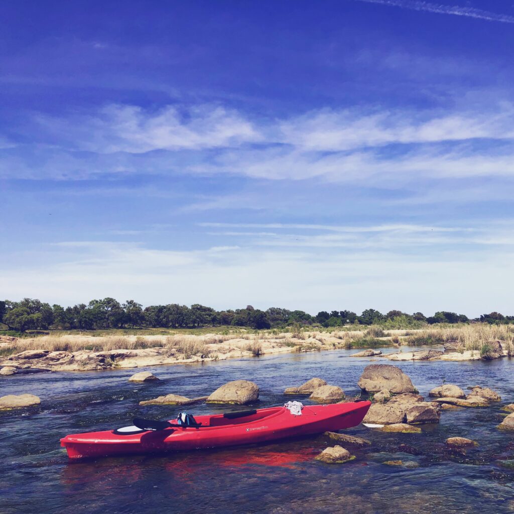
Description: The uppermost section near Uplift Landing and the most remote. The river alternates between wide, slow pools and granite boulder gardens with ledge drops. High bluffs and Hill Country ranchland line the banks. At good flow it’s very scenic and uncrowded. At low flow the wide riverbed (sometimes 100+ yards across) splits into braided channels, making navigation tedious.
Put-in: Keller’s Landing at US-87 bridge. Park on the southeast side. Limited gravel shoulder — room for a few vehicles. Not a designated lot.
Take-out: Castell General Store area / FM 2768 bridge (Castell Crossing). Designated gravel lot on the right side of FM 2768 before the bridge. Room for several vehicles and trailers. Castell General Store is nearby.
Parking: Both sites are roadside / gravel lot — do not leave valuables.
Portages: No mandatory portages — the river is open and free-flowing on this stretch.
Notes: Not a casual trip — Castell Cabin’s site calls it “a hard trip… a solid 6 hours of paddling not including fishing time.” Worth it at good flow if you know what you’re signing up for. Bring food, water, and sun protection — limited shade. Canoes and small rafts are ideal here. Tubes: absolutely not — too remote and too long to have zero control.
Sources: Texas Highways · Castell Cabin · Southwest Paddler · TRPA
Section 2: Castell (FM 2768) → Schneider Slab (CR 103)
Distance: ~5 miles
Rating: Class I–II
Ideal Flow: 500–2,000 cfs (check Mason gauge)
Est. Time: 1.5–2.5 hours
Drive from Uplift: ~15-20 min west via RR 152
Craft suitability: Canoe ✅ · Tube ⚠️ · Small raft ✅
Description: A manageable half-day float starting in the historic community of Castell. The river runs through scenic Hill Country with a mix of pool-and-drop sections. The Castell General Store rents kayaks, canoes, and offers shuttle service.
Put-in: Castell Crossing at FM 2768 bridge (same as Section 1 take-out). Gravel lot before the bridge.
Take-out: Schneider Slab at CR 103. From Llano, take RR 152 west for ~13.5 miles, then turn right onto CR-103 (Schneider Slab Road). Continue 0.3 miles to the access site on the left, before the river crossing. After the gate, continue to the parking area. Designated TPWD access parking — room for vehicles and trailers.
Parking: Both ends have designated lots. Good for car shuttles.
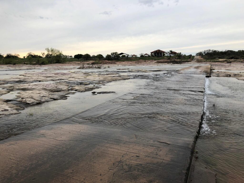
Portages: Castell Crossing is a concrete low-water ford. At moderate flows you can wade or run it; at low flows you’ll need to get out and drag. At high flows, inspect for debris.
Notes: Five miles is a long tube float — doable but you’ll be on the water a while, and you have to drag the tube across the slab at the take-out. Canoes and small rafts are ideal.
Sources: Paddling.com · Texas Highways · Castell Cabin
Section 3: Schneider Slab (CR 103) → Scott’s Crossing (CR 102)
Distance: ~5 miles
Rating: Class I–II
Ideal Flow: 250+ cfs; 500–2,000 cfs optimum (Mason or Llano gauge)
Est. Time: 1.5–2 hours
Drive from Uplift: Schneider put-in ~3-5 min west; Scott’s take-out ~2-3 min west
Craft suitability: Canoe ✅ · Tube ⚠️ · Small raft ✅
Description: A short, easy float through ranchland with gentle riffles, granite outcroppings, and gravel bars — ideal for recreational kayaks and sit-on-tops. The Landmasters blog calls it a “short day trip.” Note: this section ends just upstream of Uplift Landing — you’ll take out at Scott’s before reaching the property.
Put-in: Schneider Slab at CR 103 (same as Section 2 take-out). Designated parking area.
Take-out: Scott’s Crossing at CR 102. County Road 102 crosses the river between Schneider and Robinson Park. Park alongside the road near the bridge — no designated lot.
Parking: Designated lot at Schneider. Roadside parking at Scott’s — keep well off the travel lane.
Portages: Schneider Slab and Scott’s Slab are both concrete low-water crossings. Plan to portage or wade these except at well-above-normal flows. Scott’s Slab is generally not runnable — treat it as a take-out point.
Notes: Best section for tubing — slow current, short distance, unobstructed channel. The hassle is at both ends: dragging the tube across the slabs at put-in and take-out. Canoes and small rafts have no issues here.
Sources: Landmasters · Paddling.com
Section 4: Scott’s Crossing (CR 102) → Robinson Park
Distance: ~8 miles (7.7 mi per American Whitewater)
Rating: Class I–II+(III) — the most challenging section near the property
Ideal Flow: 500–2,000 cfs (check Llano gauge)
Est. Time: 2.5–4 hours
Drive from Uplift: Scott’s put-in ~2-3 min west; Robinson Park take-out ~10 min east
Craft suitability: Canoe ⚠️ · Tube ❌ · Small raft ⚠️
Description: This is the section that floats right past Uplift Landing. Described by American Whitewater as “arguably the most diverse kayak run of the 100+ mile Llano River system” — the steepest gradient on the Llano, with granite boulder gardens, multiple channels, and two named features:
- Finley Dam (2.5 mi below Scott’s) — An eroded century-old mill dam. Class II+ at moderate flows. Best to shoot the middle; may scrape bottom at low flows.
- Big Kahuna (4.8 mi below Scott’s) — Class III at 150–350 cfs; larger at higher flows. The biggest rapid on the route.
Put-in: Scott’s Crossing at CR 102 (same as Section 3 take-out). Roadside parking.
Take-out: Robinson Park (high side, above the dam). Off RR 152 at the western edge of Llano. Large paved parking lot. Park facilities include restrooms, picnic tables, playground, and camping. Safe for extended or overnight parking during a shuttle.
Parking: Roadside at Scott’s — keep off the travel lane. Large paved lot at Robinson Park.
Portages: Scott’s Slab (CR 102) — portage required except at very high water. Finley Dam is runnable at moderate flows (shoot the middle). Big Kahuna is a rapid, not a portage, but scouting recommended. Robinson Park Dam — take out above the dam; do not attempt to run it.
Notes: Not suitable for tubes. Canoes need spray covers and experienced paddlers to handle the boulder gardens. Small rafts (duckies, packrafts) with skilled paddlers can manage it at moderate flows. At flows above 1,500 cfs, Big Kahuna is significantly larger than its standard Class III rating.
Sources: American Whitewater · TPWD Analysis
Section 5: Robinson Park → Badu Park
Distance: ~2–3 miles (estimated)
Rating: Class I (flatwater)
Ideal Flow: No minimum — paddleable at nearly any level
Est. Time: 45 min – 1.5 hours
Drive from Uplift: ~10 min east to Robinson Park; take-out at Badu Park is near downtown Llano
Craft suitability: Canoe ✅ · Tube ✅ · Small raft ✅
Description: A gentle downstream paddle from Robinson Park’s low side (below the dam) to Badu Park in downtown Llano. Pure flatwater with no rapids — a lazy float from the western edge of town to the east side. Badu Park has restrooms, a playground, and splash pad; downtown Llano is a short walk.
Put-in: Robinson Park (low side, below the dam). Drive to the lower parking area. Large paved lot.
Take-out: Badu Park, 300 Legion Drive, Llano. Paved parking. Park includes restrooms, basketball courts, playground, splash pad.
Parking: Both ends have full city park parking. Very easy shuttle.
Portages: None between Robinson Park and Badu Park. However, the Llano Dam at Badu Park is a mandatory portage — do not attempt to run it under any circumstances.
Notes: This is your tube float. Short enough to be fun without getting cold or bored, flat enough to be safe even for kids, and it ends at a park with bathrooms. Canoes and kayaks also enjoy it — easy afternoon trip with a downtown lunch stop.
Sources: 101 Highland Lakes · Visit Llano Texas · TPWD Analysis
Suggested Trips from Uplift Landing
| Trip | Put-in | Take-out | Distance | Est. Time | Best For |
|---|---|---|---|---|---|
| Short & Sweet | Schneider (CR 103) | Scott’s (CR 102) | ~5 mi | 1.5–2 hrs | Beginners, rec SOTs, canoes — ends just upstream of the property |
| ✦ Past the Property | Scott’s (CR 102) | Robinson Park | ~8 mi | 2.5–4 hrs | Floats right past Uplift. Experienced paddlers only. |
| Longer Day | Schneider (CR 103) | Robinson Park | ~13 mi | 3.5–5 hrs | Covers both the easy upper stretch and the technical lower section |
| Full Upstream Day | Castell (FM 2768) | Robinson Park | ~18 mi | 5–7 hrs | Full day, experienced |
| Town Float | Robinson Park (low side) | Badu Park | ~2–3 mi | 45–90 min | Families, tubing, lunch downtown |
Shuttle from Uplift Landing
| Location | Drive from Uplift | Parking |
|---|---|---|
| Scott’s (CR 102) | ~2-3 min west | Roadside along CR 102 |
| Schneider (CR 103) | ~3-5 min west | Designated lot through gate |
| Castell (FM 2768) | ~15-20 min west | Gravel lot before bridge |
| Robinson Park | ~10 min east on RR 152 | Large paved lot |
| Badu Park / downtown | ~12-15 min east | Paved lot |
| Hwy 87 (Keller’s Landing) | ~35 min west via US-87 | Limited gravel shoulder |
Rentals, Shuttles & Guiding
Llano River Region Adventures — headforthehillcountry.com
Kayaks: $50/day · Canoes: $75/day · Shuttles from $40 · Guiding from $250/day
Includes PFD, paddle, dry bag, bow line with rentals.
Castell General Store — (325) 247-4100
Kayak and canoe rentals and shuttle service from Castell.
Packing & Safety Notes
- Always check the gauge — LCRA Hydromet
- Life jackets are required by law — even in shallow water
- Sun protection: limited shade on most sections
- Bring plenty of drinking water (freeze it the night before)
- The Llano is a navigable waterway — stay in the streambed and portage around hazards; do not trespass on private banks
- After heavy rain: flash flooding risk. The river can rise quickly
- Inspect all slabs and low-water crossings for debris before committing
Resources & Sources
- American Whitewater — Scott’s Crossing to Robinson Park
- Southwest Paddler — US-87 to Llano
- Southwest Paddler — Llano to Lake LBJ
- TPWD Analysis of Texas Waterways — Llano River
- Texas Highways — Paddling the Llano River
- TRPA — Llano River
- Paddling.com — Llano River Trip
- Landmasters — Kayak Llano River
- 101 Highland Lakes — Llano Parks Access
- Castell Cabin — Float Trips
- Llano River Region Adventures
- LCRA Hydromet
- USGS — Llano River near Mason
- USGS — Llano River at Llano